
Presentation of the 100 miles trail-running trip:4 days to discover and identify the route of the 100 miles Nice côte d’Azur by Utmb. You will train on the most essential portions of this ultra-trail which crosses the Alpes-Maritimes and ends up with a bath in the Mediterranean Sea.
Differences with the 6-day-trip: ● No start and downhill course towards Saint-Etienne-de-Tinée ● No stop in Saint-Sauveur-sur-Tinée
- Private minibus transfer
- Assistance along the route: aid stations, escape or alternative routes, transportation of the luggage.
- We will adjust the program according to your shape and the weather conditions as far as possible.
- Advice and coaching by qualified hiking guides from this mountain area (State-registered)
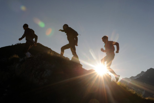
- “Reco” of 70% of the trail
- Information provided about the trail (rescue and aid stations, escape routes, facilities)
| Included | PRICE INCLUDES: |
|---|---|
| Not included | PRICE DOESN’T INCLUDE: |
| Duration | 0 Hour |
| Bring along | Your daily equipment:For the day: your guide will review the weather conditions every day and advise you on your outfit |
| Participants | Group: 6-8 participants Spectators free of charge |
| Additional information | ENG 100miles 4days.pdf |
Further information
Day 1: Welcome, transfer and presentation of the 4-day-tripWelcome of the participants at 4 pm at Nice AirportPrivate minibus transfer (75 minutes) crossing the Valley of Tinée to the lovely village of IsolaPresentation of the trip by your hiking guide and dinner. Accommodation in Isola Village / Half-board / Access to the swimming-pool / double rooms
Day 2: Haute Tinée and MercantourPrivate transfer to Saint-Etienne-de-Tinée in the morning (20 minutes)In the northern part of the County of Nice, the high Valley of Tinée is a vast indentation orientated North-South, against the Italian border. Saint-Etienne de Tinée, main town of the Northern Mercantour Massif, is overhung by the trail of energy which joins peaks over 3.000 meters high. The mineral world and the high mountain lakes testify the presence of former glaciers. Originated from a water management project, this historical trail offers incredible views on the alpine massif. The slopes are covered by one of the most beautiful larch forests in Europe. Direct arrival at your hotel. Length; ascent/descent: 28.2 km; + 2,090 m /- 2,370 m Estimated duration: 6h30 to 7h45 (including times for feeding/drinking) Refreshment station in Rabuons Accommodation in Isola Village / Half-board / Access to the swimming-pool / double rooms
DAY 3: Crests of the PrealpsStart from your gite/ No transferFrom Valdeblore (meaning the valley of tears), the summits of Caïre Gros and Brec d’Utelle allow a trail which crosses bare ridges and spruce forests, with the Mediterranean Sea in the background. Due to limestone rocks, the downhill course towards the village of Utelle is technical. Utelle is a true eyrie dominating the Valley of the Vesubie, an area of transition between mountain and Mediterranean climates. You will notice the first olive trees.Length; ascent/descent: 30 or 38 km; + 1,700 or 1,800 m /- 1,890 or 2,440 mRefreshment station (water/feeding) at the Pass of Fournes (escape route)Assistance in Utelle (escape route)Estimated duration: 6h30 to 8h30 « according to options » (including times for feeding/drinking) End of the trail in Utelle or Cros d’Utelle (according to participants)Private transfer to your accommodation (15 to 20 km) Hotel in Levens / Half-board / Double rooms
DAY 4: Le Moyen-Pays niçoisStart from your accommodation without transfer With the song of the cicadas, you will run among Alep pines, olive trees and hornbeams towards the last alpine summit: the “Férion Mount”. Dominating the Valley du Paillon, it might be considered as a gate to the metropolis of Nice, with the towns of Levens, Aspremont, Tourrette-Levens at its foot. Landscapes become more urban and houses more modern. Length; ascent/descent: 21.8 km; + 1,500 m /- 1,630 Refreshment station at the Plan de Couthon (escape route) Estimated duration: 5h30 to 6h30 (including times for feeding/drinking) Private minibus transfer to your accommodation (10 km) Hotel in Levens / Half-board / Double rooms
Day 5: The foothills of the Mediterranean Sea Transfer to the village of Tourrette-Levens or Col d’Èze (according to your shape and the weather conditions)Crossing the Paillon River, you will run uphill the mounts Leuze and Vinaigrier. Your senses will be fulfilled with Mediterranean perfumes and amazing views on the Riviera beaches. Like raptors flying over the sea, you will enjoy the breathtaking scenery on the Villefranche Bay, main harbor of the County of Nice and the Duchy of Savoy till the 18th century. You will follow a path full of history, its hills and forts dominating Nice were strategic places since the Roman times. Length; ascent/descent: 27 km; + 1,000 m /- 1,390 mEstimated duration: 5h30 to 6h30 (including times for feeding/drinking) Refreshment station at the Pass of Fournes (escape route) Assistance at Col d’Eze (escape route) End of reconnaissance on the Promenade des Anglais at the finish line. Debriefing of the week around a snack! Pick up of the luggage and end of the trip.